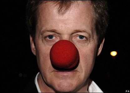
Should of course be a Pinnochio nose but a clown’s nose will have to do.
The BBC has spent a long time and invested much treasure in grooming Alistair Campbell and keeping him sweet.
As they say….keep your friends close and your enemies closer.
Such investment seems to have paid off with Campbell now back in the political game advising Miliband and saying things like this:
‘….whatever the criticisms of the BBC, it should be supported, remain central to our culture and having had the Murdochisation of the press we should resist the Foxisation of TV news…’
…as opposed to the Stalinisation of our TV news?
Nice to have ‘friends’ in high places who could potentially form part of the next government.
Campbell was speaking in his new role as visiting professor at Cambridge University (No really…that’s not a joke).
What is so funny is that he condemns the celebrity culture that has grown up in the Media…driven of course by the two spawn of the Devil…Murdoch and Dacre.
The funny bit is that he is only where he is now precisely because of his own ‘celebrity’…or notoriety….it can’t possibly be intellectual brilliance and original thought.
Read his speech and you will see it is the same old tired, cliched rhetoric about Murdoch and Co that tumbles forth off the pages of the Guardian day in day out.
The same type of unoriginal, unprovoking trite stuff that Russell Brand(one of the ‘key voices of our age’) and Owen Jones have picked up from the ‘Idiots Guide to Social Revolution’ and ‘The Bluffer’s Communist Manifesto’.
The only people who would applaud this stuff are his fellow travellers and then only out of politeness.
Here are some ‘highlights’ from his speech…
“The Murdoch-Dacre Generation Has Had Its Day”
I loved being a journalist, and it is partly the journalist in me that hates what the Murdoch-Dacre leadership has done to British journalism and its reputation.
Presumably Campbell doesn’t agree with this assessment of his own journalistic morals:
No political journalist in my lifetime has treated politicians with such utter, total and complete contempt as Alastair Campbell did during his career for the Daily Mirror and Today newspaper (and later as a government adviser inside Downing Street). His personal conduct was far, far worse and more demeaning than any Daily Mail journalist.”
“bullying and lying his way across our political life”.”
Back to Campbell’s own world view:
One of the most powerful critiques of modern journalism came from The Guardian’s Nick Davies. In his book Flat Earth News, he detailed specific acts of press distortion, manipulation and lying. But more, he made a convincing analysis that the corporatisation of the media is what has led to its decline in trust and accuracy. He calls it a cancer and argues it is beyond cure. I hope he is wrong, [but one thing is clear]…..Those who have created the cancer cannot cure it. The Murdoch-Dacre generation of owners and executives, let alone the so-called regulators at the PCC, have failed, cannot change their ways, have had their day.
Not the BBC ‘Corporation’ then that has led to a decline in trust and accuracy…and democracy?
When I was a trainee, if you had asked me my ambition, I would have said “editor of the Mirror“. Not now. I would struggle with the overwhelming celebritisation of tabloid life.
Today, broadsheets and broadcasters also fear that if they fail to run big celebrity stories, they will get their balance wrong. So Michael Jackson’s court case got 50 times more TV coverage than events in Sudan, including both Darfur, where as many as 400,000 people died between, and as the trial started, the fighting in Eastern Sudan.
As veteran BBC war correspondent then MP Martin Bell said in 2004, “the culture of celebrity, like an army of ants, has colonized the news pages, both tabloid and broadsheet”.
Power – that is another answer to the question “why journalism?” It is bad when press power is abused, as it has been. But the press as a check on power is not a bad thing per se. What is bad is when the power of the press is such that politicians feel reluctant to challenge it, when deep down they know they should.
The papers are generous to the point of ridiculous with their favourites, or where their own interests are concerned, vicious and disproportionate about hobby horses or people who cross them. The same approach is moving into TV. Fox News. Fair and balanced my backside, and a good reason why whatever the criticisms of the BBC, it should be supported, remain central to our culture and having had the Murdochisation of the press, we should resist the Foxisation of TV news, which this government almost allowed, and certainly wanted to.
And for me, the real evil of narrow concentration of press ownership by a clutch of wealthy right-wing men, most of whom do not pay taxes here, is that it leads to a narrow set of values and interests within the news agenda.
I welcome the impact of social media in breaking open the agenda setting of a self-serving political and economic elite.
David Dimbleby agrees…but not on who the ‘evil’ ones are:
‘I’ll tell you…there is an argument for funding things that are outside the BBC so it doesn’t have this all-powerful position. I’m not sure democracy is served by having an organisation so huge and powerful.’
Campbell finishes off with a contradictory plea to allow partisan, or non-objective reporting:
Alongside the myth of non interference we have the myth of press objectivity. It is possible to strive to be fair, neutral, impartial. But in every striving there are enormous cultural and specific judgements being made, and many of them are necessarily subjective.
So it is the ‘evil’ Murdoch and Dacre who have done so much damage to British journalism and its reputation and brought Society down along with it?
So that’ll be The Times and the Financial Times…and Sky…and the Daily mail which millions read…good to know what Campbell thinks of those readers.
Has he never watched TV? The BBC, Channel 4…those so called bastions of quality entertainment and taste (well, the BBC at least in theory)….they created the celebrity culture…they created the school kids who don’t want to work and dream of a get rich quick life of fame and glamour on the Telly but who ended up disgruntled and disaffected stacking shelves in Tescos or on the dole because of the cheap imported workers Labour flung open the borders for knowing the working class would be sidelined and forgotten.
I imagine Campbell doesn’t really want a chat about who really destroyed Britain….and he’s on safe ground with the BBC.
Here is Nick Cohen being rather less partisan:
It is too easy to dismiss the enormous audience for Brand by saying: “They’re just enjoying the show.” True, artists have always made a show of being drawn towards fanaticism. Extremism is more exciting and dramatic, more artistic perhaps, than the shabby compromises and small changes of democratic societies. You suspect that half the great writers of the 1920s and 1930s supported fascism or communism just for the thrill of it.
Television controllers manufacture celebrities like Volkswagen manufactures cars, and insert them into every niche in their schedules. When I have complained that the actor fronting a documentary knows nothing about African poverty, say, or the comedian on the political panel knows nothing about politics, they reply that the viewers want celebs. If they don’t put them in front of a camera, the viewers won’t watch. In a saturated media market the ambitious celebrity has to go further than the competition to stand out from the crowd.
Celebrity sells…cars, watches and telly programmes about famine.
The TV execs know it and exploit it to the full.
Campbell loses any credibility by his unbalanced and partial exercise in bashing his political, and the BBC’s, enemies.
After all he was himself one of the ones who created and used celebrity culture to add a bit of glamour to the New Labour project:
Tony Blair and Cool Britannia
Mr Blair writes: ”To this day, I’m never sure of the effect the celebrity thing has. I don’t dismiss it, as some do.
”When you are trying to capture the mood – and this is more often so for a progressive party – celebs can reinforce, even boost the message.
”They add some glamour and excitement to what can often be a dreary business.
”What they can’t do, of course, is substitute for the politics. In fact, if they try to, they become immediately counterproductive.
”If they begin lecturing the people as to why or how they should vote, it’s nearly always a disaster.
”They clearly don’t determine the outcome, but properly used, they help. And frankly, given the difficulty in rousing the damn thing, we needed the help.”
From Guido:

Campbell is attempting to rebrand as a do-gooder and saint…The new image is just not credible. Leaving aside David Kelly, lets just look at how he operated in his early days in Downing Street:
“Campbell has been on his high horse all week saying he never briefed against Tony Blair’s ministers – apart from the time he lost his temper with anti-Iraq leftie Clare Short and suggested Gordon Brown was “psychologically flawed”. Those of us with longer memories know this is spin. In May 1997 when he first arrived in Downing Street, Campbell shocked senior civil servants by telling them that two Cabinet ministers “couldn’t keep their trousers on”, that Derry Irvine, the Lord Chancellor, hated Donald Dewar, the Scottish Secretary. Smirking, he said “Nick Brown, was ever the bachelor” – before he was outed as gay. He went on to hint at the Foreign Secretary Robin Cook’s then adulterous affair with his secretary Gaynor Regan. All that was just in the first month he was in Downing Street and before he went on – as Michael Howard famously told him – “bullying and lying his way across our political life”.”
Today Peter Oborne has more:
“This protestation that he treated politicians with respect is so completely contemptuous of the truth that I feel a kind of moral obligation to correct it. No political journalist in my lifetime has treated politicians with such utter, total and complete contempt as Alastair Campbell did during his career for the Daily Mirror and Today newspaper (and later as a government adviser inside Downing Street). His personal conduct was far, far worse and more demeaning than any Daily Mail journalist.”